August 22, 2024
NAVIGATING POLYNESIA: Ancient Seafaring Traditions

The ancient Polynesians are revered for their wayfinding skills, expertly navigating vast oceans with precision by reading the stars, winds, and ocean currents.
Long before China’s Han Dynasty created the mariner’s compass (206 BC) or the invention of the sextant (1757); and way before indulgences like depth finders (1919) and GPS technology (1973)… ancient seafarers set out from Southeast Asia around 1000 BC and began to settle Micronesia and Melanesia. Over the course of the coming centuries, between 700 to 500 BC, the maritime migration continued further eastward ultimately settling the Cook Islands, Society Islands, Tuamotus, and Marquesas in what is known today as French Polynesia.
But… without radios and satellites, how in the world did they do it?
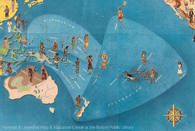
Migrating from Southeast Asia thousands of years ago, Polynesians settled the islands of French Polynesia, preserving their navigating traditions to this day as steadfastly as the rocks and reefs that shape the archipelago’s islands and atolls.
The settlement of Polynesia is one of history’s great mysteries. And even if the question of what drove a migration of people into the farthest realms of an unknown sea still remains, that the ancient Polynesians were expert navigators is accepted as a universal truth.
Bold, brave, and let’s face it, driven by some amount of curiosity, the earliest Polynesian mariners relied on a combination of reading celestial bodies, embracing oral traditions, and watching both the rhythms of the sea and the cues of wildlife to navigate the expansive waters of the Pacific Ocean. The mastery of all these techniques together is called wayfinding, and the Polynesian’s were its first professionals.
FIRST: THE STARS
 The earliest Polynesian navigators studied the night sky – its celestial bodies and constellations – memorizing positions as they changed through the seasons. The twinkling extravaganza of planets and stars, even the occasional shooting star, remains a breathtaking phenomenon of the South Pacific.
The ability to “read” the night sky is a great skill, and this expertise was the foundational tool of traditional Polynesian navigators. Upon setting out to sea, they would direct their va’a taie (twin-hulled canoe) toward a star on the horizon. Using their hand to gauge its positioning, they would follow the star, making note as it rose higher or dipped below the horizon. Another star would then be chosen to follow, and so on through the night. This mental map of the night sky was known as a star compass, which depending on the length or route of a journey could have as few as seven stars or as many as 150!
Constellations, the moon, and bright planets were also important, not just in wayfinding but in the creation of a calendar as well. Orion the Hunter is located on the Celestial Equator, making it visible all over the planet. Polaris is north of the Equator, while the Southern Cross is to the south. Moon phases and the regular paths of planets also helped give navigators a sense of direction. At daybreak, the rising sun’s path could be followed high into the sky to create an arc as to where it would set in the evening.
THEN: THE OCEAN
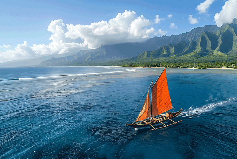
Knowledge of waves and ocean currents – and how they break onshore and on reefs – are a key component of traditional wayfinding.
The art of wave reading was passed down through generations, along with knowledge of ocean currents and trade winds. Mastering this, Polynesians developed an intricate understanding of the ocean's behavior, enabling them to predict distant storms and prevailing winds. By observing the time between wave crests—where longer intervals suggested waves originating from afar—they could anticipate approaching weather systems or nearby land masses. This allowed them to traverse unpredictable storm winds and navigate the calm yet challenging doldrums. The reliability of trade winds, especially for east-west travel, added another layer of predictability to their journeys, demonstrating the profound connection between mariners and the ever-changing sea.
NEXT: THE WILDLIFE
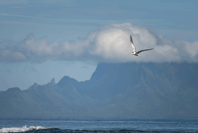
The migration routes and behaviors of seabirds served as an alert system for navigators (even now) as the behaviors of these creatures provide tell-tale signs of either land or open seas.
Marine life also served as a dynamic compass, guiding master voyagers through the vast and often uncharted waters. Seabirds, with their predictable migration patterns and routes, provided vital clues to the proximity and direction of land. For instance, certain species flew out to sea at dawn and returned to land at dusk, marking the location of islands. Some birds rarely strayed far from land, signaling nearby shores, while the majestic albatross, often spotted over the open ocean, hinted at the long distances still to be traveled. The flight direction of birds, varying with the time of day, could even suggest the best course to steer. Beyond birds, the behavior of fish revealed hidden underwater structures like reefs and currents, further enhancing the mariner's understanding of the ocean's subtle signs.
ALL HAIL THE NAVIGATOR
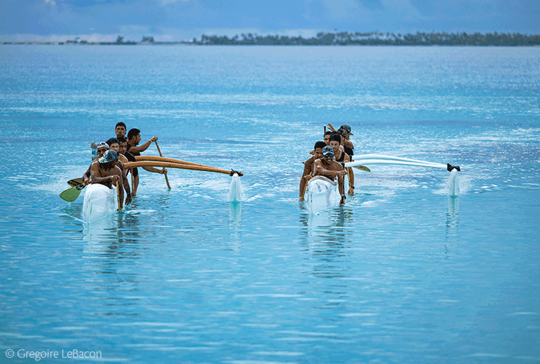
The tradition of seafaring is alive and well in the South Pacific where the teachings of ancestors have been carefully passed down from generation to generation. (Photo Credit: Gregoire LeBacon)
Master navigators were revered members of society, as the ability to understand and traverse the mighty ocean was essential for a community’s survival. Their profound connection to the Earth and its elements made their knowledge sacred; a revered gift passed down from ancestors. Aspiring navigators had to endure intense training and rigorous tests before earning the esteemed title of master. In many Polynesian cultures, the ocean voyage served (and likely still does) as a powerful metaphor for life itself: the trials of the sea—storms, shifting currents, and boundless horizons—mirror the challenges and uncertainties faced on land.
YOUR SEAFARING ADVENTURE AWAITS
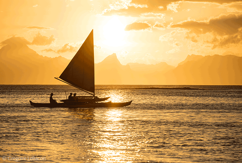
The study of charting and navigating using the stars continues to be a practiced art (and a prerequisite) for aspiring sailors. Modern navigation gadgets and wizardry are useful but when all else fails at sea, the sky and its stars will always guide sailors to where they need to be. (Photo Credit: Gregoire LeBacon)
Made of tree trunks and plant fibers (no metal!), each va’a taie could measure up to 100 feet and accommodate more than 30 people along with needed supplies as well as animals and plants to settle in their new lands. One can only imagine what a crossing from Samoa to Tahiti must have been like on an open craft in waves ranging from six to 11 feet!
Thankfully, when you choose to explore French Polynesia aboard the m/s Paul Gauguin, your passage will be much more refined as this intimate ship welcomes you aboard with spacious accommodations (nearly 70% featuring a private balcony), French-inspired local cuisine, and genuinely warm hospitality. Oh, and did we mention The Gauguin has all the “latest” navigational toys, like radios, satellites, depth finders and GPS (and even complimentary Wi-Fi!).
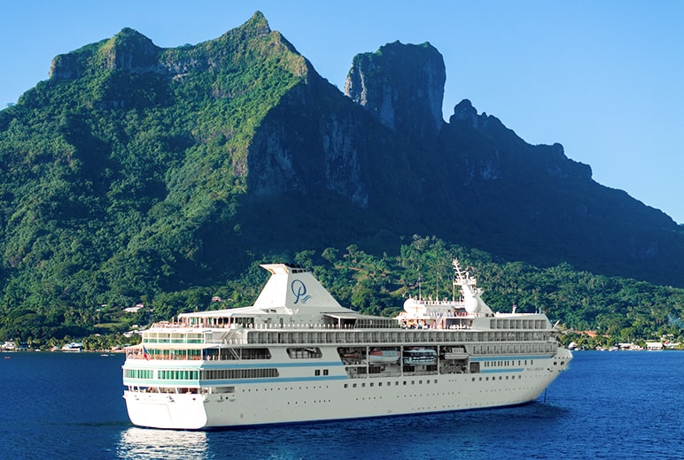
The Gauguin is honored to be part of the rich tapestry of French Polynesia.
Come and immerse yourself in the breathtaking beauty of French Polynesia. We warmly invite you to join us aboard The Gauguin for an all-inclusive, luxury voyage that celebrates the vibrant flavors, rich traditions, and stunning landscapes of these magnificent islands. Savor exquisite dishes crafted by culinary masters, embark on thrilling adventures led by local experts, dive into crystal-clear waters brimming with marine life, and let the enchanting spirit of French Polynesia guide your journey to rekindle your soul.
Book your voyage now and start exploring this little piece of paradise we call home.
PGC Blog ID 78424WE